Part of the reason it took me so long to get around to doing the Sierra High Route was a simple misunderstanding of what the trip was about. Mostly I did it because I knew it was a classic for a reason, but frankly, I couldn’t wrap my head around what it was.

They weren’t all good, but “some of the turns were magnificent…”
My perception that there wouldn’t be that many good turns to be had completely missed the mark for why you should do this tour. That’s not to say we didn’t experience some awesome turns along the way, but it wasn’t like doing laps on a powder day in the backcountry. Those were fleeting moments of downhill hedonism that simply added to the real reward of the Sierra High Route.
Just what is it that justifies lugging a turn compromising heavy pack for hours on end to cross the Sierra? Simply put, it is to immerse yourself in the grandeur of one of God’s finest creations, the Sierra Nevada.
Admittedly most of your time is spent skinning under a heavy load. But one only has to look up from the track and look around to be enthralled with the view of endless peaks stretching to the horizon in all directions. Every time we crossed a pass, a new canyon and new peaks would come in to view and overwhelm the senses.
The never ending views and the ability to travel quickly though them on skis are why you should do the Sierra High Route. To that end, let me present a few panoramas of the route, traveling from west to east along the classic route first defined by Dave Beck.

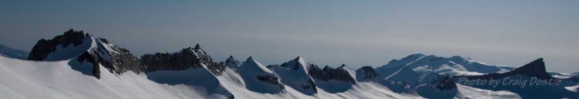
Day 2 (w-e): Looking SE from the first unnamed pass after the Tablelands.
Click to enlarge. For best results - make your browser full screen on a wide, hi-res monitor.

D2 (w-e): The view looking east (N to S) from Coppermine Pass. Just a short downhill cruise to Camp 2 and a well deserved rest.
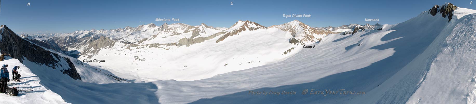
A closer view. Move your mouse to pan left or right.

D3 (w-e): Looking S after skiing down from Triple Divide Pass. A short climb to go, then a sporty descent through breakable crust and then build another camp.

D4 (w-e): The stunning view to the backside of the East Side, from above the headwaters to the Kern River

D5 (w-e): A monster of a view looking W from the Tyndall Plateau.
I should add one more thing. Although these panoramic pictures may seem beautiful, they are only illusions. To truly experience these views you need to go yourself.
© 2011
Note: Panoramic magic made possible by Hugin.
Recent Comments