About to descend into Round Valley on Hwy. 162

Looking down into Round Valley Hammerhorn Peak in background
Looking north from Mendocino Pass to Anthony Peak.

Anthony Peak
And the view of Anthony from the north. This picture was taken from South Yolla Bolly (Mt. Linn). You can see Sanhedrin Mountain and Impassable Rock in the background.

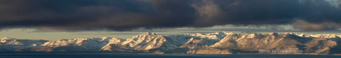
Anthony Peak from South Yolla Bolly
At the northern end of the Forest the is the Yolla Bolly- Middle Eel Wilderness. North Yolla Bolly and Black Rock Mt. are the two main peaks. Highway 36 is the access road here. The last sign of civilization is the little ‘town’ of Wildwood. An overpriced gas station and cafe sit in the middle of the woods. There is no menu, just order whatever you want – and the old guy behind the counter will make it.

Looking north from South Yolla Bolly - Black Rock Mt (L) and North Yolla Bolly (R)

The north face of Black Rock Mt.

The north face of North Yolla Bolly
South Yolla Bolly (8094′) is the tallest peak in the Mendocino National Forest. Only accessible two months a year. There is a gate controlled by a logging company that is closed December through April. This gate is 15 miles from the mountain. The gate is opened on May 1st and closes December 1st. The gate is located at 4000 feet at a place called Franklin Point on Valentine Ridge.

South Yolla Bolly from Valentine Ridge
Formerly known as Mt. Linn, this mountain is an east-west ridge with two peaks. The north face off the summit falls away almost 1000 feet, down to Square Lake. Two bowls drop off the summit. I have named the bowl dropping down to the lake, Square Bowl. Access is from the I-5. Either from Red Bluff or Corning. The entrance from Corning is easier and about 30 minutes shorter.
Google Earth likes the route that’s only available in the summer. The best way to get there is to take road A9 west from Corning towards Paskenta. Just before Paskenta, turn north (R) onto Lowrey Rd. This is a smooth gravel road. Take it to Colyear Springs Rd. Turn left (west). This will turn into road M22. Follow the signs to the Ides Cove trailhead. The snow in the Mendocino National Forest is very unique. Unlike any snow I’ve ever skied. The proximity to the Coast along with the lower elevations of these mountains keeps the snow pack more stable than elsewhere. The snow levels fluctuate and the strong California sun bakes the slopes, creating Spring-like conditions all winter.
The Yolla Bolly’s are farther north and taller, thus receive drier snow than the peaks to the south. While deep powder days are rare, the corn can’t be beat! Super smooth corn forms anytime the California sun comes out. Suncups are almost non-existant. The corn window is also unique. Early in the day, the snow is rock hard. By the afternoon, the snow is usually too soft to ski. However, it all depends on the temperature/wind/time of day/or year(angle of the sun) and the aspect of your chosen run. High clouds will hold the snow on any aspect all day. Or one can follow the sun from east to south and finish up the day with a western descent.
Hull Mountain has the best access to every aspect on the compass. The past two decades have only strengthened my resolve to explore these mountains even more. The more I discover, the more I realize I have not even begun to scratch the surface of what’s available here.
More resources on the next page…
4 pings
[…] More photos and directions on the next page… […]