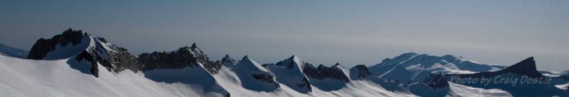
Standing 14,375 feet tall, Mount Williamson appears to be the highest peak and is the biggest massif visible from California State Highway 395. (Mount Whitney which sits a few miles south of Williamson is the highest peak in the lower forty-eight, but it is among the second tier of peaks farther from the road, and appears lower.) At first glance, Williamson’s north wall looks better suited for climbers. For practitioners of the steep, however, the granite ribs simply define the boundaries of a playground.

The Giant's Steps Couloir cascades diagonally across Mt. Williamson's north face.
On Memorial Day, May 24, 1998, Dave Braun skied the entire length of The Giant’s Steps and solved one of the last coveted problems of the eastern Sierra. Eric McGrath made a descent from just under the headwall, riding caboose on the first descent.

Step 1. Make sure your first turn is solid - 'cuz you only get one chance.
Two disinct jags in the couloir hint at a discontinuous line. As it turns out, whether you look from below, above, near or far, it’s difficult to determine if the line even goes. This element of uncertainty no doubt shriveled the huevos of the few locals capable of descending it earlier.
Dave Braun possesses a six-foot-one-inch frame that packs 190 pounds of determination. A mechanical engineer by day, he works in Pasadena for Jet Propulsion Labs. “It keeps cobwebs off the cranium,” he insists. He manages time off to enjoy fifty days a year of skiing in the Sierras, the San Gabriels or the Wasatch on weekends. Dave takes his skiing seriously. A nine to fiver must carefully pick objectives. His trips include places like New Zealand, Nepal, Peru, Alaska (Mt. Fairweather, Couloir Vol. IX-4 Mar./Apr.97), and Kyrgystan (Pik Pobeta, Couloir Vol. XI-4, Jan.’99).
Last year Dave decided to take a break from world traveling, but he still yearned for something serious. The Giant’s Steps was, if not obvious, certainly a worthy target.

Step 2, same as the first step only easier now that you have a rhythm.
With so much uncertainty surrounding the descent, and even more surrounding the approach, Dave knew that scouting the route would be essential. Using tidbits of information he’d been able to amass, his goal was to find a rocky corridor on the western flank that led up to the summit plateau, and to then drop down the north side of Williamson via The Giant’s Steps couloir. The key was learning exactly which gully on the west would share the same col as the couloir on the north. The previous year a colleague of Dave’s had told him about a west gully route he’d climbed that shared access to the north face from a notch on the summit ridge, but, he remarked, “there’s no way [the north couloir] is skiable. It’s straight down!” Dave relished the challenge.
April 17th was the date of a reconnaissance mission. Braun hiked up Shepherd Creek with his camera and returned to his desk for the week with photos that he programmed as his screen saver. The line beckoned to him each day from his computer screen.

Step 3. Aw you're makin' it look easy Dave.
For his third attempt in as many weeks, he managed to hitch a ride to the trailhead, but the ride left with his boots. Foiled again.
On May 24th Dave finally put all the pieces of the puzzle together. Armed with perfect weather and new details on the exact location of this western gully, Dave Braun and partner Eric McGrath, were finally poised to begin the first descent of The Giant’s Steps.

From the metropolis of Independence, CA, the line looks more continuous and steeper – naturally
In the morning they skied to the base of the west face and began kicking steps up a corridor of hard snow, the one and only route from the west that intersected with the elusive Giant’s Steps Couloir. Two hours later he made it to the col, where a mere foot of sharp granite separated the two couloirs and determined whether snow fell on the north or the west flank of Williamson’s huge shoulders.

Closer view of the line with a bit of photoshop enhancement to make it easier to see.
The entire run starts at about 14,100 feet and drops 3,100 vertical feet. The first pitch begins with a clean, intimidating 54° headwall. After a couple of turns it mellows to 50°, then 45°, before ending abruptly at the first “giant step.” A cliff yawned below while Dave and Eric kicked steps over the cornice and on to the second pitch.
Once atop the first step, with his skis safely underfoot, Dave beheld an even narrower slot in the face. It had no headwall but its average pitch was steeper, at about 46°. The third pitch—a jagged hallway of steep, narrow twists and turns, eventually opened up to the final pitch of wide 38° fun. Unlike a traditionally shaped couloir whose crux is at the top, Dave recalled that the exposed breaks in the line kept the skiing exciting. Making the third descent, this writer didn’t relax until the lower apron.
Most of the notorious East Side lines require a skier/rider who feels comfortable on 50° slopes, an upper level skill to be sure. But the ascents rarely require more than fair weather and bomber snow, both common in the Sierra Nevada. Perhaps the good ol’ boys responsible for many of the East Side’s first descents knew that the bragging rights wouldn’t stand up to a traditional mountaineer’s standards of profound risk. Routes like The Giant’s Steps, however, with its huge approach and hungry cliffs are challenges more akin to mountaineering than glisse alpinism. Perhaps this “last great problem” of the East Side will herald the beginning of bolder mountaineering descents deeper into the Sierra Nevada.
3 comments
1 ping
Ah…when I saw the title I thought you’d just recently skied it somehow. That cursed wind hasn’t been kind to the big north faces this year. It sure shut down all my Williamson plans.
It’s great to see the profile of Dave and how he put this one together. Such a huge, huge line. I was just looking at Dav’s book, and pondering the conspicuous omission of Dave’s name on the Giant’s Steps page.
Maybe you could be the one to start fixing the record and compiling a list of Sierra first descents? I think it’s time to purge the territorial surfer mindset from CA ski mountaineering…
Author
SierraDescents (aka AL),
Changing the territorial mindset of CA ski mountaineers is a lost cause. To set the record straight would require WAY too much time and effort in tracking down who did what and when. It would be nice to have a record of such events, but a little investigation on many of the key firsts in the region suggests that the published record of who did what when, and first, is deserving of suspicion.
For instance, the first descent of Mt. Whitney is acknowledged to be by Orland Bartholomew, per his own diaries recording his descent. Yet this descent was contested by Otto Steiner, not based on Orland’s claim to have descended it on skis, but on actually being able to link turns. Otto’s perspective was that Orland was the first to descend Mt. Whitney with skis attached to his feet, but Otto made the first ski descent. The difference in their skiing skills lends credence to this claim. I would add that if I fell down a slope with skis on that would hardly qualify as a first descent. Claiming a first descent implies that it was done with skill and without flailing the whole way down.
Regarding Braun’s claim of a first descent, this too is dubious but if anyone else did it before he did, they have not stepped up to dispute the claim. Therefore, I say, and knew when publishing the story, that even someone else may have actually skied it before Dave Braun, Braun gets the prize for claiming it. Even in having done it, his record of being first was only made public due to my personal relationship with Dave, and thus being made aware of his descent. Others may have done it before, and like them, Braun was reluctant to make a big deal of it. I saw it as a big deal, and made it a big deal. But if a tree falls in the wilderness and nobody is around to see it, does it make a sound when it falls?
Not sure if a “fall” in first descent should be a disqualifying factor. I guess it depends on how far you tumble. I have fallen (hard hip checks) on a few firsts then gone back in later years and skied the same line better…or worse. I still log the earliest as the first. Some times a first descent has variety of factors that may complicate things like lousy snow, for instance. Main thing is skis on with some turns.
Of course there are no first ski descents with helicopters setting a skier on top. That would be cheating the ski mountaineer who may want to claim the first descent with an ascent. That has long been recognized by the international alpine and mountaineering community as the only way to claim a first anything in the mountains. I call it the the “DUH” criteria.
Tabitha and I have camped at Guitar Lake on the N of Mt. Williamson after summiting Whitney via Army Pass from Horsehoe Meadow a few year back. Impressive mountain. Hard to visualize anything skiable on the wall we camped beneath. I am always amazed at what folks can ski.
[…] is a great write up on the full history of this line HERE at Earn Your Turns. Well worth the few minutes to read. Giant Steps is the main chute […]