TR: Shasta’s West Face

 
Even though it was a meager season, Eleven-12 has served up some delicious ski days. Rather than let the season fizzle with a wimper, BergBryce put out a call to rally for a trip to Mt. Shasta. Inspired by Jibmaster’s photos of Shasta’s north side, I responded and the trip was inked.

Mt. Shasta (14,179') from Hwy. 44 view-point (near intersection w/Hwy. 89)
click to enlarge all photos


We headed up Friday afternoon – from South Lake Tahoe to Truckee to Reno to Susanville to Mt. Shasta City.

A group of chargers blows by us around 8,000' in Avalanche Gulch.

The original plan was to retrace Jibmasters route and drive to 7,000 feet on the north side, then climb and ski the Bolam Glacier. Either that or climb Shastina and either ski Diller Canyon, or the NW face and then traverse around back to the base of Diller.

After talking to TeleWoman and Don at the Mt. Shasta Ranger station we concluded that BergBryce’s Subaru would get beat up too much for either trailhead. That left us with the standard approach up Avalanche Gulch from Bunny Flat. It did not sound that appealing since we wanted to do something different, not the standard trade route.

Our route.

Brewer Creek was out, as was Clear Creek since the road’s were covered with snow more than a mile back. So we decided to ski the West Face.

The standard approach for the West Face is to camp at Hidden Valley but that meant camping overnight and this was going to be a wham-bam one-day affair. BergBryce was concerned that Bunny Flat would be a zoo, but I assured him the only real negative was following an established trail full of foot prints instead of a smooth, clean, untracked slope of snow.

bergbryce refuels at Lake Helen.

We started skinning from Bunny Flat about 6am and considered following avalanche gulch part way up, then crossing over to the west face via one of the windows in the red rocks defining Casaval Ridge. However, it looked like that would mean some mixed climbing and a sizeable traverse across the West Face to get to continuous snow. We opted to stick to the standard route up Avalanche Gulch to The Thumb, then continue above Red Banks to the plateau below Misery Hill. From there we could cross over a couple hundred yards to the top of the West Face.

bergbryce harvesting corn.

This proved to be a superb strategy, although we were certainly questioning it as we cramponed up from Lake Helen to the Red Banks. Moving past the Heart seemed to take forever and it nearly broke my resolve to keep putting one foot in front of the other. The crunchy, still frozen surface did not feel like it would soften for a good descent and it was already 11am.

Coming up to Lake Helen there was a superb staircase of well spaced steps carved into the slope. In the steep pitch next to the Heart the existing steps had zero discernible rhythm and every time I tried to take advantage of the security those steps provided, the random, inconsistent spacing only magnified my discouragement at how interminably long this pitch felt. Thankfully the snow was crunchy and easy to grip with crampons and slow, steady switchbacks eventually paid off.

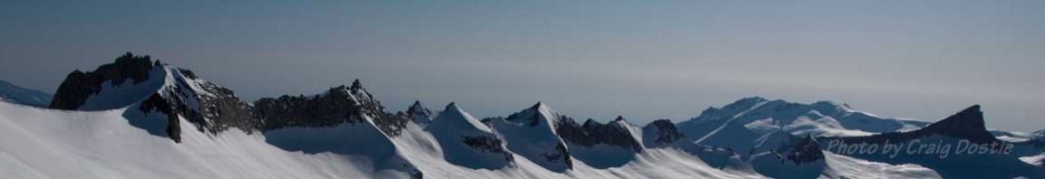
Looking E from West Face entrance to Shasta's summit and Misery Hill.

During our food break at tent city by Lake Helen I suggested that since BergBryce was climbing faster, if he wanted should move at his own pace, bag the summit, and meet me at the top of Red Banks before traversing over to the West Face. However, when I arrived at the top of Red Banks he was waiting, having run out of water and experiencing cramping in his legs. He had gone through more than two liters already and I still had two left. I give him a liter of water, plus a good slash of coconut water rich in electrolytes and we shared an orange. Then I took the lead and set a series of switchbacks at a tortoise pace and we made the crest of Avalanche Gulch in 15 minutes.

Dostie cutting corn.

It was a short traverse across the top of Avalanche Gulch to the top of the West Face, but the snow was pretty heinous – refrozen wind blasted sastrugi with edges made of iced teeth. We were afraid our first turns down the West Face would consist of this junk. In fact, as we stood on the roll over facing south towards Casaval Ridge that is what the snow looked like. But when we looked behind us, towards Shastina, the snow had been protected from the wind and it rolled over with a smooth creamy surface of corn. The wind was gone, it was 2pm, and the slope beckoned.

What followed was nearly 4,000 vertical feet of 100% ego corn, perfectly ripened, never over done, all the way down to Hidden Valley at a pitch that varied from 35° at the top to 25° near the bottom with a nice mini-couloir connecting the ramp we were on to Hidden Valley below with a few turns in the 40° range. Ordinarily Shasta serves up a nice slice of corn in between an upper pitch of firm snow and a bottom pitch of mush. Somehow we managed to hit the magic hour and the entire West Face was excellent corn from top to bottom.

bergbryce enjoying turns beside Shastina


...and more turns...


...and more...


From the bottom at Hidden Valley we turned left and held a high traverse around the fanned out based of Casaval Ridge. In a mere 15 minutes we were back to the standard, pock-marked trail up Avalanche Gulch and the snow was still in good corn condition.

Turns from the top to the bottom, every one in Shasta corn.


By 4:30pm we were back at the car, and headed for Mexican food in Mt. Shasta city. Round trip time on the mountain – about 10 hours.

The Route on Google Topo Map

© 2012

5 comments

2 pings

Skip to comment form

  1. Yeehaw!

  2. Nice. Made it up there the day before ya.

  3. Hey Dostie…I was in the group of chargers that passed you at 8,000 in avy gulch (the only one still skinnin’). We were all locals and the other 4 ended up skiing Konwokiton then up and over Shastarama (Sargents ridge) into the old ski bowl. They reported perfect corn on all aspects as well. As for me, I hooked up with a friend just above Helen and we skied the trinity chutes, dropping in around 12:30. Firm at top but not for long…cause the corn was buttery smooth the rest of the way down. What a day! Glad you and Bergbryce got some of the goods…way to go!

    • Dostie on 14May2012 at 3:51 pm
      Author

    Way to Rock! Work Stinx skis, right?

    We were wondering where y’all descended. Knew it couldn’t be the way most folks were coming down…in crampons with skis on their back ‘cuz the route up was still funky and they didn’t think they could handle any other route. I was puzzled why they weren’t dropping in next to the Trinity’s – under Red Banks. Seems like an obvious route that isn’t too rad.

    Konwakiton to Shastarama. That sounds great. Glad we went for something new.

  4. yep…that was me in the work stinx setup. showing my rondo boys tele lives on! many folk come up to shasta with grand ideas of ski mountaineering but don’t realize the variables…then just want to get down safely (good choice). but if you can ski, then the lines are plentiful! the line you mention to the skiers left of trinity chutes can be tricky up top cause of steepness, but then settles in nicely. novice skiers get freaked. diller is in for another week…but probably not much more. if you want more beta on that route…email me at tmankuz@yahoo.com thanks for your reviews…saves me time and keeps me informed!

    TK

  1. […] Posts Shasta the Masta’ TR: Mt. Shasta’s West Face TR:Sick trip to Shasta’s N. Side Share this:PrintEmailShareStumbleUponDiggRedditpinterest […]

  2. […] 2013   Related Posts Mt. Shasta via Brewer Creek Mt. Shasta’s West Face Mt. Shasta’s Hotlum Glacier Mt. Shasta from the North Mt. Shasta, the Masta‘ Share […]

Leave a Reply

This site uses Akismet to reduce spam. Learn how your comment data is processed.