SICK adventure on Shasta’s N-side
(continued)
About 11:30am some movement caught my eye. A rock was rolling slowly down the icy snow towards me. The rock -like me – didn’t look like it was in a hurry, so I adjusted my line and watched it roll on down the hill. I was almost there. Perfect timing. I was at the base of a large bowl, surrounded by rocky outcroppings that had more ammunition to let loose. I made it to 9400′ at the top of a patch of rocks right at noon. Six hours after I had started. Only 2400′ above the Jeep.

Topping out on a sick day..
It felt like I had been asleep forever when I startled myself awake. I had to get out of here before I ended up staying up here so I set about to head down. Took one last shot before skiing.

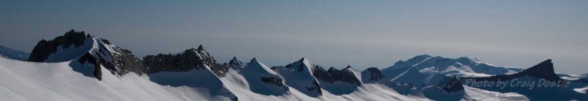
Looking down to where the Jeep is parked
By 12:45, I was skiing. The snow had softened up a bit, but was still really firm. I headed over to the left to get some corn on an eastern aspec and found some slightly chilled butter.
Skiing down through the woods was awesome! The snow stayed firm and fast. Once the gullies start, there are some fun lines through the trees. Ended up taking the skis off a few minutes after that video and hiking down. After ten minutes of booting it through the trees and snow patches I was on the road only a couple hundred feet up the road from the Jeep.

The junction of roads 42N34 and 42N16 (the main route to North Gate TH).
On the drive back, I cut across on road 42N34 over to the main route. This road is not marked, but it’s located at the base of the large moraine. It meets up with road 42N16, which is the main road for the North Gate TH. It is marked on this end however. As you drive up to the North Gate TH on the main route, you’ll see this white sign on the right.
I turned right and headed up towards the trailhead. Found deep drifts covering the road at the usual spot for this time of year. Right about at 6500′ – see previous map – where the ‘B’ is.
This is an excellent approach – IF you have the proper vehicle. A simple pickup could make the journey, but a minivan would never make it.
I never liked all the weaving around heading back to the North Gate TH from the upper mountain. This approach allows you to keep skiing straight down once treeline is attained.
Got a couple more photos on the drive back home.

Diller Cyn. looking good.

Won't last long.
That was a SICK! day. I totally got served. Oh, well. I’ll be back.
Google Map of directions to Shasta Northside Trailhead

Take Hwy 97 to Military Pass Rd (S). R on 42N18, R on 42N33 and follow to 7000'.
© 2012
Pages:
- 1
- 2
3 comments
2 pings
Good solo stuff. “Right where I wanted to be” is always a nice feeling on an approach.
i noticed you’re using the Rossi BC 110’s. Like them? I have them with dynafits and tlt 5 boots. A fun light setup. nordiskimo! who knew?
Author
Yeah, I like those skis. I got the 110’s instead of the 125’s to keep the weight down.
Worked well for the Crater Lake Circumnavigation.
[…] Posts Shasta the Masta’ TR: Mt. Shasta’s West Face TR:Sick trip to Shasta’s N. Side Share this:PrintEmailShareStumbleUponDiggRedditpinterest Posted in Mt Shasta Tags: Brewer Creek, […]
[…] via Brewer Creek Mt. Shasta’s West Face Mt. Shasta’s Hotlum Glacier Mt. Shasta from the North Mt. Shasta, the Masta‘ Share this:PrintEmailShareStumbleUponDiggRedditpinterest Posted in […]