Snowhounds love to watch the weather. Not just to see what’s coming, or know when to enjoy what it has wrought, but to go out and embrace it while it’s happening. It’s part of why I like skinning up in a storm. You’re totally immersed in a swirling dance of snowflakes. No matter whether they’re floating down in a slow waltz through space, or ricocheting like pinballs in a mosh pit, the immersion in their energy fuels my anticipation for the ski descent back down.
Knowing when to go is essential to maximizing when you take time off of work to play in the snow. So watching the weather becomes essential. And finding reliable information is the criteria by which all forecasts should be judged.
My go-to site for reliable snow forecasts is snow-forecast.com. Like many other weather sites there are a ton of options for viewing what’s coming, but I’ve narrowed my choice to one page that lets me view all the major ski regions in the world. Naturally I go to Northern California 99% of the time. But it’s just as easy for me to see what my friends around the states are about to receive, and perhaps as important when traveling, how much they received in the last week.
One of the features not evident from these pictures is the option to show freezing level contour lines. This helps to know how warm the storms coming are, and by moving through time in 12-hour segments makes it easy to see how the snow will change over time. Wind arrows are another option, helping with estimates for leeward deposition zones. This helps immensely not only for predicting avy danger, but what locations to hit for the best pow.
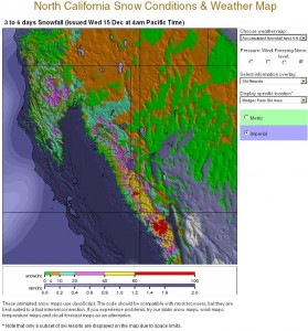
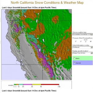
As an example of their map styles, but more importantly, their accuracy, consider the two pictures on the right. The top one shows the prediction on Dec. 15th for how much snow would fall 4-6 days out. The bottom pictures shows what fell in the ensuing 4 days. If you look at the scales you’ll notice that the amount that fell was only slightly less than the amount that was predicted.
Now it’s possible that was a lucky guess, but in the five years I’ve been relying on snow-forecast.com they have only let me down 2-3 times. Over five years that’s not bad at all. Usually they predict less snow than actually falls. Those rare let downs were weak storms that turned out even weaker in the midst of a weak year.
This latest storm delivered a bit less than predicted, but not by much. Their margin of error was far less than what the weather channel offers, and without having to subject myself to the stupevision.
A lot of people I know rely on NOAA. There’s so many options on that site it numbs me. It’s why I like Snow-Forecast. Now that I have my main page saved, it’s simple and fast and I don’t have to waste time figuring out a site that buries me with so many options. However, if you’re game to share some of your faves, I’d love to add ’em to the Nav section on the left. Just leave ‘em in the comments.
Hope you have plans for time with family, relaxing, and whether you earn your turns or burn ‘em, enjoy the holiday spirit for the next few days. Avoid the malls and have a Merry Christmas!


Recent Comments