Shasta is still in great shape so I headed up again with some company this time – Glen (switchtele) and Too Tall Terri from Tahoe joined me. We headed for the north side.

From just past the railroad tracks on Military Pass Rd.
Glen’s Subaru Forester was about to be tested on the road to the Coquette Falls TH. This is the same place I was at back on May 2nd. The snow had melted on the road and I wanted to see how close we could drive to the Wilderness Boundary.

Road map to
Coquette Falls TH.
(click to enlarge)
This trailhead is the place to go if you’re looking to hit the north side. I decided to call it the Coquette Falls TH. The road called Bolam Logging Road, or road 42N33, heads for the Wilderness Boundary and is perfectly positioned to allow direct access to the bottom of the Bolam Glacier. It is also a great way to access the north side of Shastina.
Drive in to the North Gate TH on Military Pass Rd.(43N19), stay right onto 42N16 – the way to North Gate. But turn right onto 42N34. Head up and around the large moraine on 42N33, also known as the Bolam Logging Road.
This is where the road gets a bit rough. Glenn drove like a pro and his Subaru Forester made it.
Subaru Forester on the Bolam Logging Rd.
The road makes a beeline for the Wilderness Boundary with excellent views.
View from Jibmasters Jeep.
The road gets pretty rutted with some big rocks. A few rocks were moved and lines were scoped out, but the Subie was able to keep on truckin’.

Coquette Falls TH camp.
We drove to about 7300′ and the road at this point got to be more of a drainage or creek with deep ruts and really loose sand. I opted to hike up the road and see how far we could drive. The Jeep could have gone on farther, but the Subie would have had trouble, so we decided to call it for the day and set up camp. I took another hike over to the right to check out the Bolam Creek drainage.
A deep canyon, probably about 500 feet deep that reminded me of Mud Creek Canyon, but not as deep. We were camped about a five minute walk from the Bolam Creek Canyon.

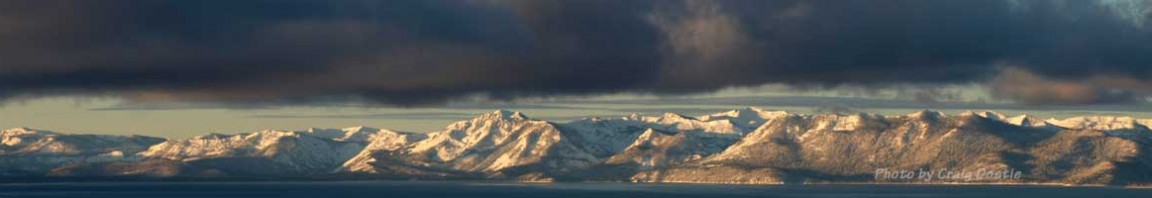
Mt. Shasta's northern slopes at sunset.
The deep sand made for a nice camp site and we prepared dinner and were crashed out just after sunset. The next morning, we set out up the road. The deep ruts soon ended and the road smoothed out. I saw a road taking off to the left on my hike the evening before, but we didn’t see it in the dark on our way up in the morning. The road soon turned into a trail that leads to a smaller washed-out creek that parallels the Bolam Creek Canyon. We hiked up this drainage and soon got to a sign that stated that we were about to cross over into the Wilderness Boundary.
My original plan was to try and head over to the main route coming up from the North Gate TH. But we were too far to the right. A few visuals showed that we were still right next to the Bolam Creek Canyon. Studying the map and Google Earth over the past several days, I was intrigued at the possibility of heading to the right and accessing the bottom of the Bolam Glacier.
We were so close to the north side of Shastina, we considered heading over there as well.

The rising sun lights up the Bolam Glacier.
By now we were committed to the right side of the large moraine and the bottom of the Bolam Glacier. A bit of bushwacking through the small trees gets us closer.

The head of the Bolam Creek Canyon - a dried up waterfall.
…more good photos as the adventure continues on the next page (2)…
© 2012
2 comments
1 ping
You nailed it. Great stuff. Go little subie!
jib means a half assed slide on a box in the park or random object. you dont jib up shasta
[…] TR: Mt. Shasta – Jibbing from Coquette Falls Archives […]